Table of Contents Show
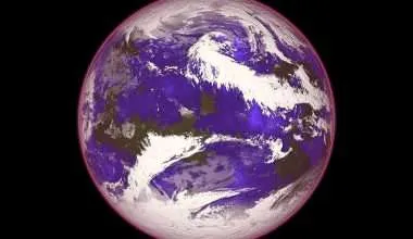
The location defines any ocean storm. For instance, a storm in the Atlantic Ocean and Northeast Pacific is called a hurricane. If an identical kind of storm materializes in the Northwest Pacific, it is called a typhoon. And if those similar storms occur in the Indian Ocean and South Pacific, these are known as tropical cyclones.
What is a Cyclone?
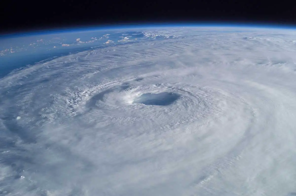
A cyclone is any rotating storm that spins around a low-pressure center. The low-pressure center is also known as the eye of the storm, which is renowned for being unnervingly calm in contrast to the parts under the whirling arms of the storm.
One could say that the eye views the events unfurling below, so it requires a clear path. However, the arms are where all the extreme winds occur since this is where the storm is hurling out all of its rain and wind.
What is an Anticyclone?
An anticyclone (the reverse of a cyclone) is a weather event described as a large-scale flow of winds around a center point of high atmospheric pressure. The direction of winds is Counterclockwise in the Southern Hemisphere and clockwise in the Northern Hemisphere.
Aftereffects of surface-based anticyclones comprise clearing skies and drier, colder air. Fog can, too, build overnight within an area of higher pressure.
Types of Cyclones
1. Tropical Cyclone
The National Weather Service refers to a tropical cyclone as a spinning structure of clouds and thunderstorms above tropical or sub-tropical areas. The major tropical-cyclone regions are the North Atlantic (plus the Caribbean), Western Pacific, Eastern Pacific, Southern Pacific and Australian region, North Indian Ocean, and Southwest Indian Ocean.
Characteristically, tropical cyclones progress within 5 to 30 degrees latitude because they need ocean waters of around 80 degrees Fahrenheit to materialize. Winds funnel into a low-pressure commotion vaporizing warm surface waters and discharging energy as rising air condenses into clouds.
2. Meso Cyclones: Tornado Factories
Aggressive thunderstorms are known as supercell thunderstorms which produce most of the strongest tornadoes and display rotating updrafts termed meso cyclones.
Spinning “wall clouds” can come down from meso cyclones and eventually create a funnel cloud, which turns into a tornado when it comes into contact with the ground. The United States encounters almost 1,700 meso cyclones per year. About half of these become tornadoes.
3. Midlatitude or Extratropical Cyclones
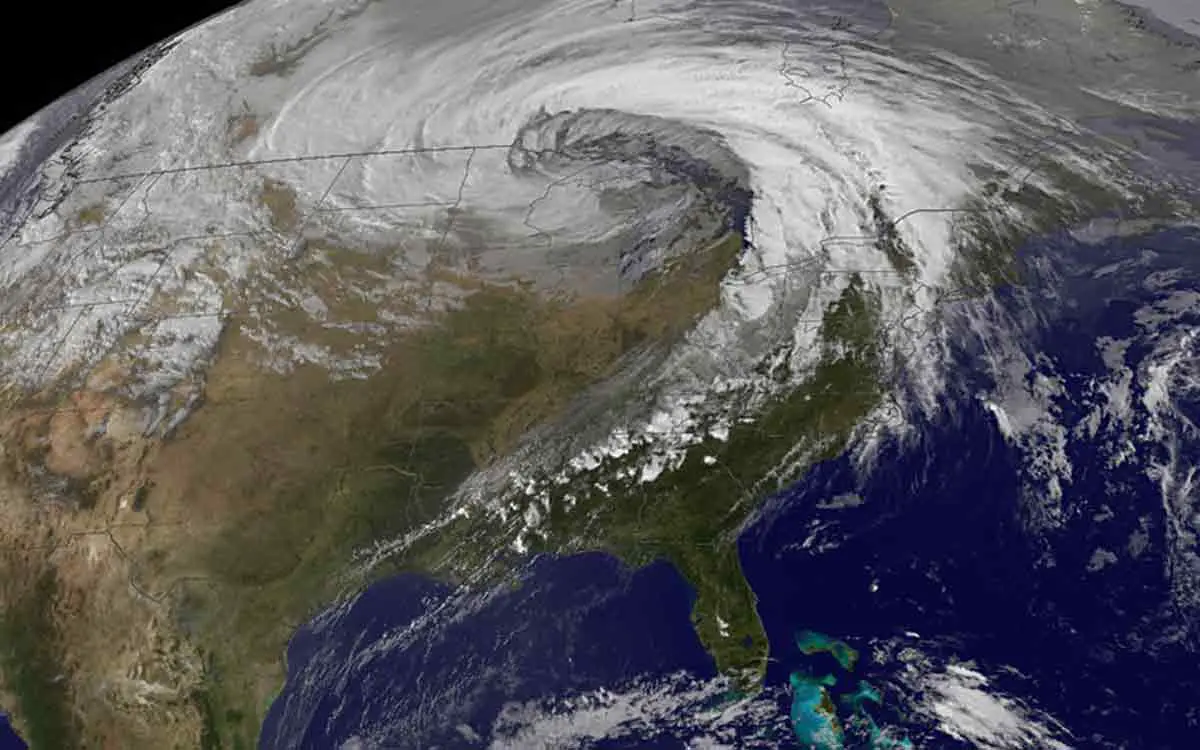
Although many people are familiar with Hurricanes and typhoons, cyclonic tempests that build along frontal boundaries in the middle latitudes called midlatitude cyclones or extratropical cyclones are just as noteworthy.
These cyclones vary from the tropical equivalents and mature when sharp temperature gradients happen amid contiguous air masses. They could be much bigger than hurricanes, though their winds are usually weaker.
Moreover, a well-known instance of a midlatitude cyclone is the “nor’easter” which frequently affects the East Coast of the USA in winter.
4. Polar Lows, aka Arctic Hurricanes
Hurricane-like cyclones known as polar lows sometimes develop over Arctic and Antarctic seas, triggered by cold air moving over warmer ocean waters. In the Northern Hemisphere, meteorologists occasionally call polar lows “Arctic hurricanes”.
Polar lows are named Arctic Hurricanes because of their energy foundation – heat transference from water to air and underlying heat released by cloud condensation – and their spiraled cloud bands are analogous to a tropical cyclone. Polar lows usually develop swiftly, sometimes in less than 24 hours, and can be tough to forecast.
Cyclone v/s Tornado v/s Hurricane
Cyclone
A cyclone is a weather system of briskly rotating air massed about a low-pressure center, typically coming with stormy and harsh weather. Storms that start in the Southern Pacific are named cyclones. It has the following characteristics:
- The winds move counterclockwise in the northern hemisphere and clockwise in the southern hemisphere.
- Normally pretty strong. The scale for assessing cyclones is called the Saffir-Simpson and Beaufort Scale and can differ in different countries. Also,winds can reach 300 kph and bring about extensive damage.
- Locations usually include the Indian Ocean and the Southern Pacific Ocean. Cyclones in the northwest Pacific that get up (exceed) 74 mph are typhoons.
- Most affected areas include the Western Pacific Ocean.
- Frequency: 10-14 every year.
- Occurrence: Warm regions and Form of precipitation: rain
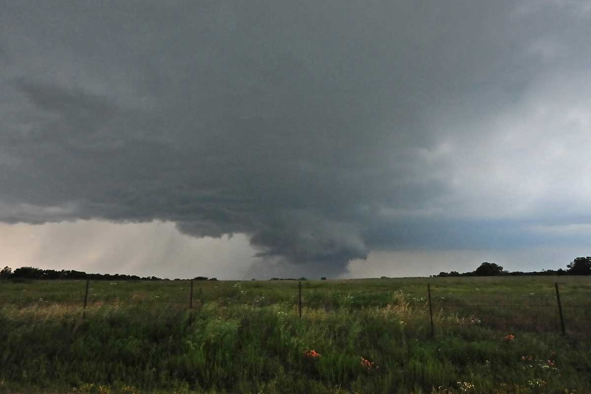
Tornado
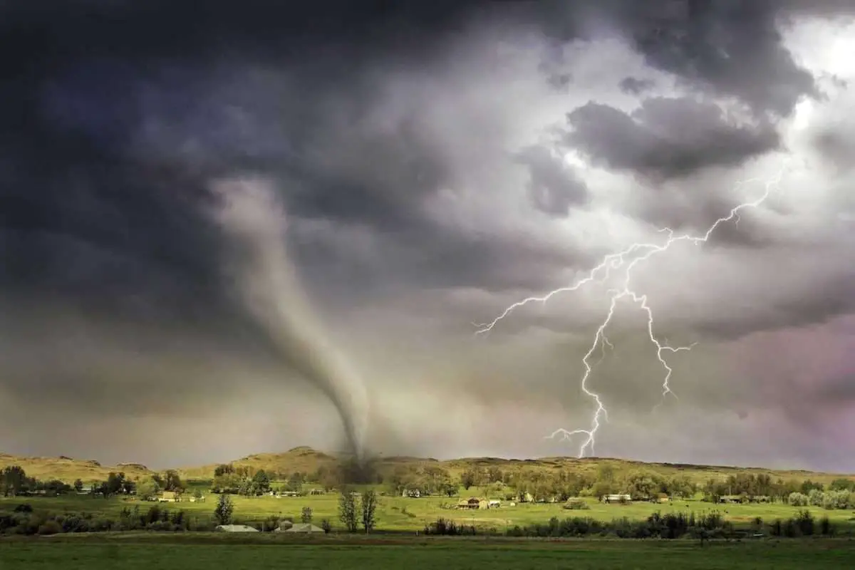
A tornado is a spinning column of air oscillating in size from some yards to more than a mile and rotating at damagingly high speeds, typically coming with a funnel-shaped downward extension of a cumulonimbus cloud. Winds vary from 40mph to more than 300 mph. The main features are:
- Counterclockwise winds in the northern hemisphere and clockwise in the southern hemisphere.
- The scale used for scoring the power of tornadoes is called the TORRO (T) Scale. Fujita (F), and Enhanced Fujita (EF).
- Tornados have occurred on all continents, excluding Antarctica.
- It usually happens in regions at a junction of cold and warm fronts as the Midwest of the USA.
- The United States records around 1200 tornadoes annually. Further, the Netherlands has more tornadoes per area compared to other nations. Tornadoes generally arise in the spring and fall but are less frequent in winter.
- Moreover, any area where cold and warm fronts meet is susceptible to this storm. And it could be virtually any place.
- Also tornados may have various forms of precipitation as rain, snow, sleet, and hail.
Additionally, Tornadoes with two or more vortexes can whirl about one shared center and look like a lone funnel. The types of tornadoes comprise fire whirls, daredevil, gustnado, steam devils, waterspouts, and multiple vortexes.
The hue of tornadoes differs depending on the area where they happen and by the color of the debris and soil amassed. For example, tornadoes with less of this load may seem white or gray, tornadoes in the Great Plains have a reddish color because of the shade of the soil, and tornadoes that come about in the hilly snow-covered area turn white.
Hurricane
A hurricane is a cyclone that usually arises in the North East Pacific Ocean east of the International Date Line, the North Atlantic Ocean, or the South Pacific Ocean east of 160E. And it has constant winds that extend to or exceed 74 mph.
The word hurricane is from the Spanish word Huracan, derived from the language of the Taino, an ancient Caribbean people.
These powerful storms have the following aspects:
- They move Counterclockwise in the northern hemisphere and clockwise in the southern hemisphere.
- Hurricanes have five classes categorized according to the Saffir-Simpson Hurricane Wind Scale. The wind speed and extent of damage escalate from Category 1 to Category 5.
- Furthermore, hurricanes are also located close to the tropical region, above the warm waters of the Pacific Ocean and Atlantic.
- Most affected areas include the Caribbean Sea.
- Frequency:10-15 every year.
- Occurrence: mainly warm areas.
- Forms of precipitation: Rain
A hurricane is a tropical cyclone with continual winds that surpass 74 mph, accompanied by thunder, lightning, and rain.
Hurricanes build above ocean water that is warmer than 26.5 Celsius. Warmth and humidity from the ocean create the base of this kind of storm.
Therefore hurricanes fizzle out quickly above land and cold waters, where sufficient warmth and moisture are insufficient to sustain the storm.
The low-pressure centers of these storms are called the eye and are hotter than their surrounding areas. Gale-strength winds and rain encircle the eye. This zone is called the eye wall.
Hurricanes do not have fronts. The frequency of these storms spikes from the middle of August to late October in the Atlantic Ocean.
How do cyclones, typhoons, and hurricanes get their names?
World Meteorological Organization (WMO) maintains a rotating list of names for storms. WMO consults with regional metrological organizations and names each twister.
It gives each thunderstorm a female and male name alternatively in alphabetical order. For instance, the first six of the 21 names allocated by WMO for 2023 are:
- Arlene
- Bret
- Cindy
- Don
- Emily
- Franklin
Conclusion
Hurricanes, typhoons, and tropical cyclones are essentially the same weather phenomenon. They are all large tropical storm systems that revolve around an area of low pressure and produce heavy rain and high wind speeds.
The difference between them is purely geographic. Each storm has the name of a woman or man for easier identification and usage.